Search results
Search found 15 Ramsar Sites covering 3,666,651 ha
- (-) Remove Threats: Agriculture & aquaculture filter Threats: Agriculture & aquaculture
- (-) Remove Region/country: Europe filter Region/country: Europe
- (-) Remove Region/country: Latin America and the Caribbean filter Region/country: Latin America and the Caribbean
- (-) Remove Region/country: Armenia filter Region/country: Armenia
- (-) Remove Region/country: Russian Federation filter Region/country: Russian Federation
- (-) Remove Region/country: Paraguay filter Region/country: Paraguay
- (-) Remove Transboundary Site: No filter Transboundary Site: No
- (-) Remove Region/country: Dominican Republic filter Region/country: Dominican Republic
Map
Materials presented on this website, particularly maps and territorial information, are as-is and as-available based on available data and do not imply the expression of any opinion whatsoever on the part of the Secretariat of the Ramsar Convention concerning the legal status of any country, territory, city or area, or of its authorities, or concerning the delimitation of its frontiers or boundaries.
List
-

Chany Lakes
-
Country:Russian Federation
-
Designation date:13-09-1994
-
Site number:680
-
Published since:27 year(s)
364,848 ha -
-
Estero Milagro
-
Country:Paraguay
-
Designation date:07-06-1995
-
Site number:731
-
Published since:28 year(s)
25,000 ha -
-
Islands in Ob Estuary, Kara Sea
-
Country:Russian Federation
-
Designation date:13-09-1994
-
Site number:676
-
Published since:27 year(s)
128,000 ha -
-
Karaginski Island, Bering Sea
-
Country:Russian Federation
-
Designation date:13-09-1994
-
Site number:694
-
Published since:27 year(s)
193,597 ha -
-


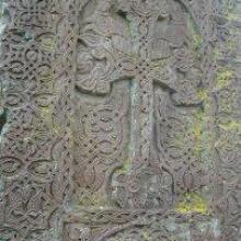
Khor Virap Marsh
-
Country:Armenia
-
Designation date:25-01-2007
-
Site number:1989
-
Published since:13 year(s)
50 ha -
-
Lago Ypoá
-
Country:Paraguay
-
Designation date:07-06-1995
-
Site number:728
-
Published since:28 year(s)
100,000 ha -
-
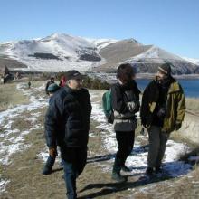
Lake Arpi
-
Country:Armenia
-
Designation date:07-06-1993
-
Site number:621
-
Published since:13 year(s)
3,230 ha -
-


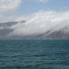


Lake Sevan
-
Country:Armenia
-
Designation date:07-06-1993
-
Site number:620
-
Published since:13 year(s)
490,231 ha -
-


Los Humedales de Montecristi y la Línea Noroeste
-
Country:Dominican Republic
-
Designation date:13-10-2022
-
Site number:2497
-
Published since:1 year(s)
84,322 ha -
-
Parque Nacional Manglares del Bajo Yuna
-
Country:Dominican Republic
-
Designation date:02-02-2013
-
Site number:2091
-
Published since:11 year(s)
77,519 ha -