Search results
Search found 43 Ramsar Sites covering 1,541,655 ha
- (-) Remove Region/country: Oceania filter Region/country: Oceania
- (-) Remove Ramsar criteria: 3 filter Ramsar criteria: 3
- (-) Remove Wetland type: Human-made wetlands filter Wetland type: Human-made wetlands
- (-) Remove Ecosystem services: Provisioning Services filter Ecosystem services: Provisioning Services
- (-) Remove Region/country: Europe filter Region/country: Europe
- (-) Remove Threats: Pollution filter Threats: Pollution
- (-) Remove Wetland type: 2: Ponds filter Wetland type: 2: Ponds
- (-) Remove Threats: Agricultural and forestry effluents filter Threats: Agricultural and forestry effluents
Map
Materials presented on this website, particularly maps and territorial information, are as-is and as-available based on available data and do not imply the expression of any opinion whatsoever on the part of the Secretariat of the Ramsar Convention concerning the legal status of any country, territory, city or area, or of its authorities, or concerning the delimitation of its frontiers or boundaries.
List
-

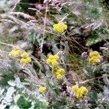
Velence and Dinnyés Nature Conservation Area
-
Country:Hungary
-
Designation date:11-04-1979
-
Site number:183
-
Published since:7 year(s)
1,354 ha -
-


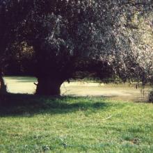
Marais Vernier et Vallée de la Risle maritime
-
Country:France
-
Designation date:18-12-2015
-
Site number:2247
-
Published since:8 year(s)
9,564 ha -
-

Etangs du Lindre, forêt du Romersberg et zones voisines
-
Country:France
-
Designation date:02-02-2003
-
Site number:1267
-
Published since:21 year(s)
5,308 ha -
-


Sim Maiakiv Floodplain
-
Country:Ukraine
-
Designation date:24-12-2013
-
Site number:2273
-
Published since:7 year(s)
2,140 ha -
-
Comana Natural Park
-
Country:Romania
-
Designation date:05-03-2009
-
Site number:2004
-
Published since:12 year(s)
24,963 ha -
-


Lower Dniester
-
Country:Republic of Moldova
-
Designation date:20-08-2003
-
Site number:1316
-
Published since:20 year(s)
60,000 ha -
-


Ottenby
-
Country:Sweden
-
Designation date:05-12-1974
-
Site number:17
-
Published since:5 year(s)
1,856 ha -
-

Ócsai Turjános
-
Country:Hungary
-
Designation date:17-03-1989
-
Site number:418
-
Published since:8 year(s)
1,146 ha -
-


Poleski National Park
-
Country:Poland
-
Designation date:29-10-2002
-
Site number:1565
-
Published since:5 year(s)
9,762 ha -
-
Oberrhein / Rhin Supérieur
-
Country:Germany
-
Designation date:28-08-2008
-
Site number:1809
-
Published since:15 year(s)
25,117 ha -