Search results

Map

Choose map: | | Download Centroids / Boundaries / Map (pdf)
Materials presented on this website, particularly maps and territorial information, are as-is and as-available based on available data and do not imply the expression of any opinion whatsoever on the part of the Secretariat of the Ramsar Convention concerning the legal status of any country, territory, city or area, or of its authorities, or concerning the delimitation of its frontiers or boundaries.

List

  1. Ramsar logo

    Grassland Ecological Area (GEA)

    • Country: 
      United States of America
    • Designation date: 
      02-02-2005
    • Site number: 
      1451
    • Published since: 
      19 year(s)
    65,000 ha
  2. Ramsar logo

    Tofutsu-ko

    • Country: 
      Japan
    • Designation date: 
      08-11-2005
    • Site number: 
      1557
    • Published since: 
      18 year(s)
    900 ha
  3. Ramsar logo

    Rudrasagar Lake

    • Country: 
      India
    • Designation date: 
      08-11-2005
    • Site number: 
      1572
    • Published since: 
      18 year(s)
    240 ha
  4. Ramsar logo

    Lake Elmenteita

    • Country: 
      Kenya
    • Designation date: 
      05-09-2005
    • Site number: 
      1498
    • Published since: 
      18 year(s)
    10,880 ha
  5. Ramsar logo

    Bertiandos and S. Pedro of Arcos Lagoons

    • Country: 
      Portugal
    • Designation date: 
      02-12-2005
    • Site number: 
      1613
    • Published since: 
      18 year(s)
    346 ha
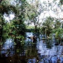
  6. Selva Baja Inundable
    Vista aérea de islas de Selva Baja inundable en temporada de secas, indispensables para los ciclos reproductivos de diferentes especies de fauna silvestre
    Arroyo hediondo es la única conexión por donde ingresa la marea y ingresan los manatís al complejo de pantanos
    Arroyo hediondo es la única conexión por donde ingresa la marea y ingresan los manatís al complejo de pantanos
    Visión parcial de una parvada de más de 11,000 pichichis (Dendrocygna autumnalis) observada en enero de 2005 descansando en los humedales de la Popotera durante su migración.
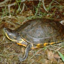
    La Tortuga Pinta (Trachemys venusta) es la especie que permanece mayor tiempo asoleándose sobre los pantanos y puede observarse fácilmente.
    La Tortuga Blanca (Dermatemys mawi) es la especie de tortuga dulceacuícola en mayor peligro de extinción en México, y estos humedales representan uno de sus últimos refugios en el estado de Veracruz.

    Humedales de la Laguna La Popotera

    • Country: 
      Mexico
    • Designation date: 
      05-06-2005
    • Site number: 
      1462
    • Published since: 
      18 year(s)
    1,975 ha
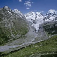
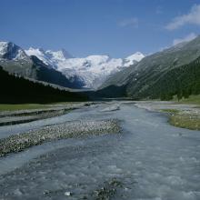
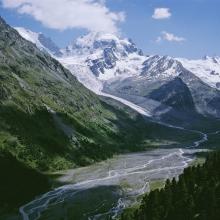
  7. Proglacial margin of Vadret da Roseg, crossed by a brook. In the background, the Roseg glacier and the Bernina massif.
    Alluvial zone including a mountain lake and the Roseg glacier.
    Brook crossing the proglacial margin. In the background, the Roseg glacier.
    Proglacial margin crossed by a brook. In the background, the Tschierva (left) and Roseg (right) glaciers.
    Meandering of a brook through the proglacial margins of Vadret da Tschierva and Vadret da Roseg, in the Roseg valley.

    Vadret da Roseg

    • Country: 
      Switzerland
    • Designation date: 
      02-02-2005
    • Site number: 
      1446
    • Published since: 
      5 year(s)
    383 ha
  8. Ramsar logo

    Dinder National Park

    • Country: 
      Sudan
    • Designation date: 
      07-01-2005
    • Site number: 
      1461
    • Published since: 
      19 year(s)
    1,084,600 ha
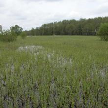
  9. The territory is located in the interfluve of rivers Pripyat and Prostyr and annually is flooded during the spring for about 3 month.
    The black alder waterlogged forest is situated along the Prostyr river.
    Floodplain meadows during the flood.
    Floodplain meadows during the flood.
    The considerable part of floodplain meadows are overgrown with reeds due to cessation of traditional use of the floodplain.

    Prostyr

    • Country: 
      Belarus
    • Designation date: 
      18-10-2005
    • Site number: 
      1611
    • Published since: 
      7 year(s)
    9,544 ha
  10. Ramsar logo

    Nakaumi

    • Country: 
      Japan
    • Designation date: 
      08-11-2005
    • Site number: 
      1551
    • Published since: 
      18 year(s)
    8,043 ha

Pages

Stats


Exports

Export Sites information

For a summary list of all the Ramsar Sites in pdf format, click here.

Generate reports of selected Sites

You can generate a report based on the filters you have applied, in either pdf or xls format. The report will sort the results by the Site name, unless you have sorted them by another variable.

For the pdfs, you can choose whether to include the introductory text on each Site, or just show the key data in a shorter report.

To receive a report, please provide your email address and enter the text in the verification picture into the textbox.

As soon as the list has been generated an e-mail will be sent to you with the link to access the file.