Search results
Search found 333 Ramsar Sites covering 39,406,481 ha
- (-) Remove Region/country: Oceania filter Region/country: Oceania
- (-) Remove Picture available?: Yes filter Picture available?: Yes
- (-) Remove Threats: Water regulation filter Threats: Water regulation
- (-) Remove Region/country: Africa filter Region/country: Africa
- (-) Remove Region/country: Europe filter Region/country: Europe
- (-) Remove Region/country: Madagascar filter Region/country: Madagascar
- (-) Remove Region/country: Democratic Republic of the Congo filter Region/country: Democratic Republic of the Congo
- (-) Remove Region/country: Latin America and the Caribbean filter Region/country: Latin America and the Caribbean
Map
Materials presented on this website, particularly maps and territorial information, are as-is and as-available based on available data and do not imply the expression of any opinion whatsoever on the part of the Secretariat of the Ramsar Convention concerning the legal status of any country, territory, city or area, or of its authorities, or concerning the delimitation of its frontiers or boundaries.
List
-


Rio Negro
-
Country:Brazil
-
Designation date:19-03-2018
-
Site number:2335
-
Published since:2 year(s)
12,001,614 ha -
-

Ngiri-Tumba-Maindombe
-
Country:Democratic Republic of the Congo
-
Designation date:24-07-2008
-
Site number:1784
-
Published since:6 year(s)
6,569,624 ha -
-


Bassin de la Lufira
-
Country:Democratic Republic of the Congo
-
Designation date:31-10-2017
-
Site number:2318
-
Published since:6 year(s)
4,470,993 ha -
-


Amazon Estuary and its Mangroves
-
Country:Brazil
-
Designation date:19-03-2018
-
Site number:2337
-
Published since:5 year(s)
3,850,253 ha -
-

Reentrancias Maranhenses
-
Country:Brazil
-
Designation date:30-11-1993
-
Site number:640
-
Published since:2 year(s)
2,680,911 ha -
-


Rio Juruá
-
Country:Brazil
-
Designation date:29-09-2018
-
Site number:2362
-
Published since:2 year(s)
2,136,489 ha -
-


 en pleine activités")
")
")
Le Lac Alaotra : Les Zones Humides et Bassins Versants
-
Country:Madagascar
-
Designation date:09-09-2003
-
Site number:1312
-
Published since:7 year(s)
722,500 ha -
-


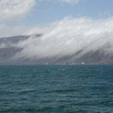

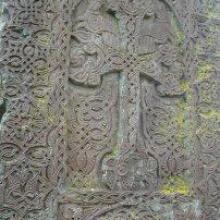

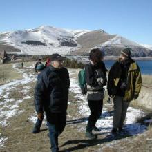

Lake Sevan
-
Country:Armenia
-
Designation date:07-06-1993
-
Site number:620
-
Published since:13 year(s)
490,231 ha -
-
")
")
")
")


 par l’orpaillage et la construction de la rizière")


Rivière Nosivolo et affluents
-
Country:Madagascar
-
Designation date:17-09-2010
-
Site number:1916
-
Published since:7 year(s)
358,511 ha -
-
")
")
")
")
")
")
Etangs de la Champagne humide
-
Country:France
-
Designation date:05-04-1991
-
Site number:514
-
Published since:4 year(s)
255,800 ha -