Search results
Search found 12 Ramsar Sites covering 687,425 ha
- (-) Remove Region/country: Oceania filter Region/country: Oceania
- (-) Remove Threats: Water regulation filter Threats: Water regulation
- (-) Remove Region/country: Asia filter Region/country: Asia
- (-) Remove Wetland type: Inland wetlands filter Wetland type: Inland wetlands
- (-) Remove Region/country: North America filter Region/country: North America
- (-) Remove Region/country: Kyrgyzstan filter Region/country: Kyrgyzstan
- (-) Remove Region/country: Europe filter Region/country: Europe
- (-) Remove Wetland type: Va: Montane wetlands filter Wetland type: Va: Montane wetlands
Map
Materials presented on this website, particularly maps and territorial information, are as-is and as-available based on available data and do not imply the expression of any opinion whatsoever on the part of the Secretariat of the Ramsar Convention concerning the legal status of any country, territory, city or area, or of its authorities, or concerning the delimitation of its frontiers or boundaries.
List
-


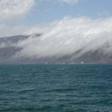

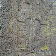

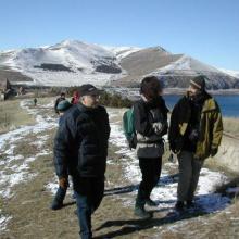

Lake Sevan
-
Country:Armenia
-
Designation date:07-06-1993
-
Site number:620
-
Published since:13 year(s)
490,231 ha -
-


Sjaunja
-
Country:Sweden
-
Designation date:05-12-1974
-
Site number:32
-
Published since:7 year(s)
181,333 ha -
-

Estrela Mountain upper Plateau and upper Zêzere River
-
Country:Portugal
-
Designation date:02-12-2005
-
Site number:1614
-
Published since:18 year(s)
5,075 ha -
-


Havmyran
-
Country:Norway
-
Designation date:06-08-2002
-
Site number:1190
-
Published since:6 year(s)
3,872 ha -
-


")


")


Pestersko polje
-
Country:Serbia
-
Designation date:19-03-2006
-
Site number:1656
-
Published since:4 year(s)
3,421 ha -
-


Pohorilets River Headwaters
-
Country:Ukraine
-
Designation date:20-03-2019
-
Site number:2397
-
Published since:4 year(s)
1,625 ha -
-


Laubersmad-Salwidili
-
Country:Switzerland
-
Designation date:02-02-2005
-
Site number:1444
-
Published since:7 year(s)
1,376 ha -
-


Rhonegletschervorfeld
-
Country:Switzerland
-
Designation date:02-02-2005
-
Site number:1445
-
Published since:7 year(s)
317 ha -
-
Pürgschachen Moor
-
Country:Austria
-
Designation date:05-09-1991
-
Site number:532
-
Published since:18 year(s)
62 ha -
-
Rotmoos im Fuschertal
-
Country:Austria
-
Designation date:16-02-1995
-
Site number:719
-
Published since:21 year(s)
58 ha -