Search results
Search found 625 Ramsar Sites covering 102,839,485 ha
- (-) Remove Threats: Transportation and service corridors filter Threats: Transportation and service corridors
Map
Materials presented on this website, particularly maps and territorial information, are as-is and as-available based on available data and do not imply the expression of any opinion whatsoever on the part of the Secretariat of the Ramsar Convention concerning the legal status of any country, territory, city or area, or of its authorities, or concerning the delimitation of its frontiers or boundaries.
List
-

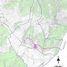
Lafnitztal
-
Country:Austria
-
Designation date:20-02-2002
-
Site number:1169
-
Published since:22 year(s)
2,180 ha -
-


Sørkapp
-
Country:Norway
-
Designation date:12-11-2010
-
Site number:1965
-
Published since:5 year(s)
55,203 ha -
-
Praia da Vitória Marsh
-
Country:Portugal
-
Designation date:13-12-2012
-
Site number:2099
-
Published since:10 year(s)
16 ha -
-
Estuário do Sado
-
Country:Portugal
-
Designation date:08-05-1996
-
Site number:826
-
Published since:27 year(s)
25,588 ha -
-
Estuário do Tejo
-
Country:Portugal
-
Designation date:24-11-1980
-
Site number:211
-
Published since:32 year(s)
14,563 ha -
-
Planalto Central das Flores
-
Country:Portugal
-
Designation date:16-06-2008
-
Site number:1806
-
Published since:15 year(s)
2,572 ha -
-
Sapais de Castro Marim
-
Country:Portugal
-
Designation date:08-05-1996
-
Site number:829
-
Published since:27 year(s)
2,235 ha -
-
Gornje Podunavlje
-
Country:Serbia
-
Designation date:13-11-2007
-
Site number:1737
-
Published since:16 year(s)
22,480 ha -
-
Labudovo okno
-
Country:Serbia
-
Designation date:19-03-2006
-
Site number:1655
-
Published since:17 year(s)
3,733 ha -
-
Domica
-
Country:Slovakia
-
Designation date:02-02-2001
-
Site number:1051
-
Published since:17 year(s)
622 ha -