Search results

Map

Choose map: | | Download Centroids / Boundaries / Map (pdf)
Materials presented on this website, particularly maps and territorial information, are as-is and as-available based on available data and do not imply the expression of any opinion whatsoever on the part of the Secretariat of the Ramsar Convention concerning the legal status of any country, territory, city or area, or of its authorities, or concerning the delimitation of its frontiers or boundaries.

List

  1. Forêt à mangrove
    Banc de sable marin
    Rivage  de sable fin
    Lagune de Yombo
    Forêt à raphiales
    Fleuve Kouilou
    Forêt à mangrove

    Bas-Kouilou-Yombo

    • Country: 
      Congo
    • Designation date: 
      25-09-2017
    • Site number: 
      2325
    • Published since: 
      6 year(s)
    55,124 ha
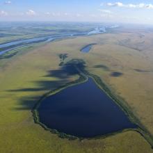
  2. Landscape view Torneträsk-Soppero nature reserve.
    Landscape view Torneträsk-Soppero nature reserve

    Pirttimysvuoma

    • Country: 
      Sweden
    • Designation date: 
      19-03-2013
    • Site number: 
      2177
    • Published since: 
      6 year(s)
    2,586 ha
  3. Beauty of Begnas and Rupa Lake
    Dipang Lake
    Gude Lake
    Khaste Lake
    Phewa Lake
    Rupa Lake
    Niurini Lake
    Maidi Lake
    Sunset in Begnas Lake

    Lake Cluster of Pokhara Valley

    • Country: 
      Nepal
    • Designation date: 
      02-02-2016
    • Site number: 
      2257
    • Published since: 
      8 year(s)
    26,106 ha
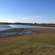
  4. One pasture in Skälderviken
    The Lagoons in Skälderviken

    Skälderviken

    • Country: 
      Sweden
    • Designation date: 
      14-11-2001
    • Site number: 
      1127
    • Published since: 
      5 year(s)
    1,463 ha
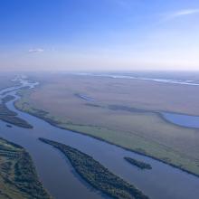
  5. Aerial view of Ilha Grande
    Aerial view of Ilha Grande
    Aerial view of Ilha Grande

    Ilha Grande National Park

    • Country: 
      Brazil
    • Designation date: 
      30-09-2017
    • Site number: 
      2316
    • Published since: 
      6 year(s)
    76,033 ha
  6. Klingnauer Stausee

    Klingnauer Stausee

    • Country: 
      Switzerland
    • Designation date: 
      09-11-1990
    • Site number: 
      507
    • Published since: 
      5 year(s)
    364 ha
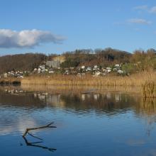
  7. Barrea Lake, on the right Barrea town
    By the shores of Lake Barrea
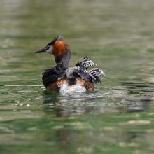
    Svasso Maggiore/Great Crested Grebe
Podiceps cristatus
    Wetland vegetation
    Barrea Lake from the village of Barrea. In the background the village of Civitella Alfedana far centre and Villetta Barrea far right

    Lake Barrea

    • Country: 
      Italy
    • Designation date: 
      14-12-1976
    • Site number: 
      131
    • Published since: 
      2 year(s)
    241 ha
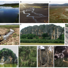
  8. A, B, C) Sumidouro Lake in diferent seasons, D) sinkholes of the Sumidouro Lake, E) Limestone massif of the Cerca Grande State Park and archaeological site, F) Canyon in the Baú Cave limestone, G) Flooded doline in Cerca Grande, H) Lush forest, I) trunk and roots of a dry forest tree. J) Lapa Vermel

    Lund Warming

    • Country: 
      Brazil
    • Designation date: 
      05-06-2017
    • Site number: 
      2306
    • Published since: 
      6 year(s)
    23,865 ha
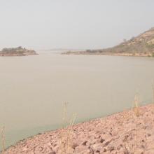
  9. Photo 1 : Vue du barrage de la Kompienga
    Photo 2 : Plan d'eau du barrage de la Kompienga
    Photo 3 : Installation pour la production de l'hydro-électricité
    Photo 4 : Equipement de production de l'hydroélectricité

    Barrage de la Kompienga

    • Country: 
      Burkina Faso
    • Designation date: 
      07-10-2009
    • Site number: 
      1875
    • Published since: 
      6 year(s)
    17,545 ha
  10. Photo 1 : AGEREF
    Pratique de la Chasse sportive dans le site Ramsar
    Sortie d'éducation environnementale avec les élèves du CEG de Folonzo
    Cérémonie de récompense des meilleurs producteurs RNA 2015 des villages membres de l'AGEREF/CL en présence des autorités régionales

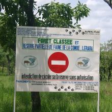
    La Forêt Classée et Réserve Partielle de Faune Comoé-Léraba

    • Country: 
      Burkina Faso
    • Designation date: 
      07-10-2009
    • Site number: 
      1878
    • Published since: 
      7 year(s)
    124,510 ha

Pages

Stats


Exports

Export Sites information

For a summary list of all the Ramsar Sites in pdf format, click here.

Generate reports of selected Sites

You can generate a report based on the filters you have applied, in either pdf or xls format. The report will sort the results by the Site name, unless you have sorted them by another variable.

For the pdfs, you can choose whether to include the introductory text on each Site, or just show the key data in a shorter report.

To receive a report, please provide your email address and enter the text in the verification picture into the textbox.

As soon as the list has been generated an e-mail will be sent to you with the link to access the file.