La Petite Camargue
La Petite Camargue
- Country:
- France
- Site number:
- 786
- Area:
- 42,156.5 ha
- Designation date:
- 03-01-1996
- Coordinates:
- 43°34'44"N 04°14'27"E
Carousel
Carousel


Materials presented on this website, particularly maps and territorial information, are as-is and as-available based on available data and do not imply the expression of any opinion whatsoever on the part of the Secretariat of the Ramsar Convention concerning the legal status of any country, territory, city or area, or of its authorities, or concerning the delimitation of its frontiers or boundaries.
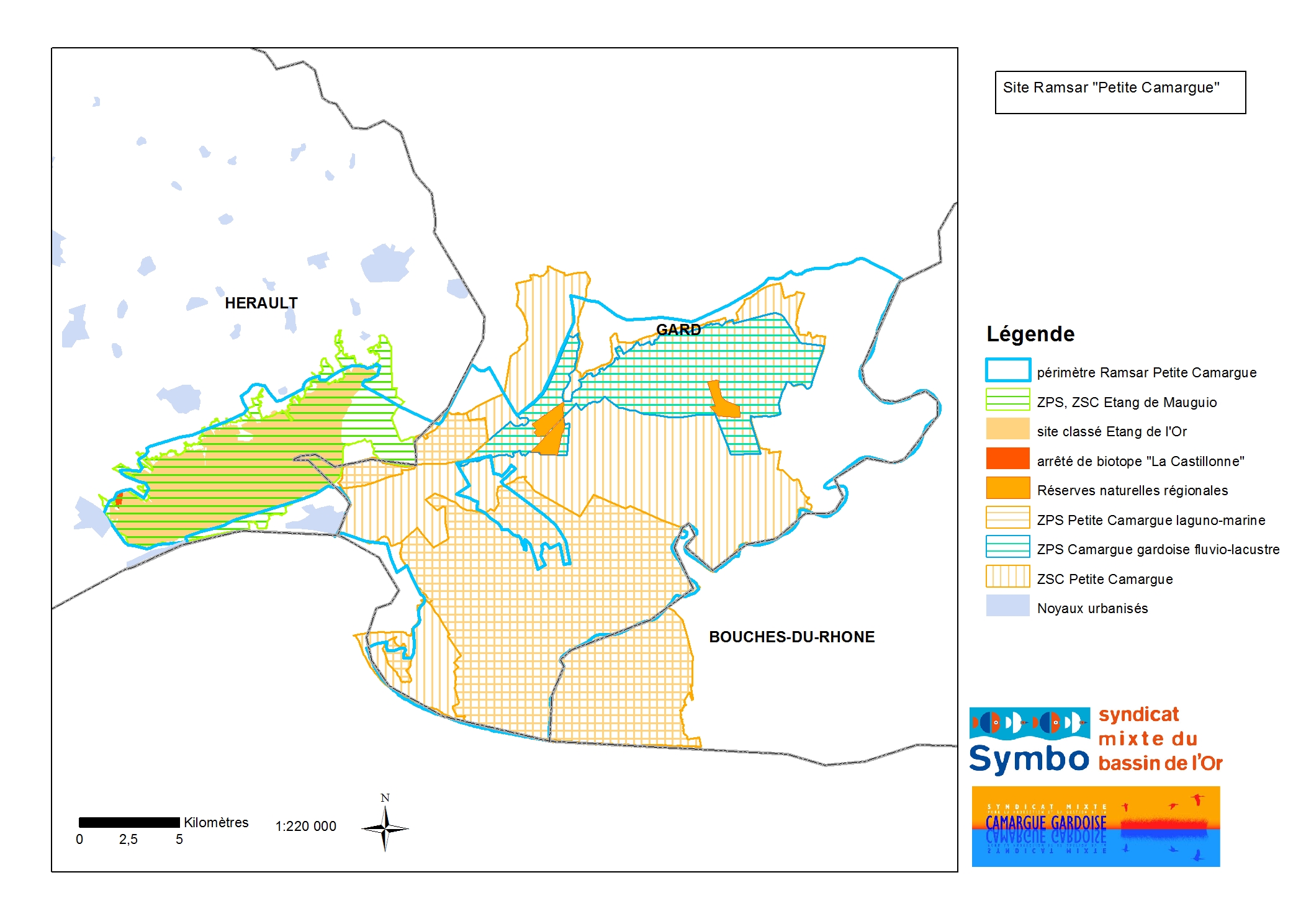
The Site is characterized by a wide diversity of natural and anthropized environments, including dunes, lagoons and marshes, which support a wide range of plant and animal species. Among the most noteworthy protected plant species are the localized and highly significant coastal communities of orchid (Spiranthes aestivalis) and nationally significant communities of Loddon lily (Leucojum aestivum). The Site supports more than 1% of the global populations of bird species such as the slender-billed gull (Chroicocephalus genei), whiskered tern (Chlidonias hybrida), gull-billed tern (Gelochelidon nilotica) and the black-winged stilt (Himantopus himantopus). There is also a significant residual population of the European pond terrapin (Emys orbicularis) in the fluvio-lacustrine zone, while the critically endangered European eel (Anguilla Anguilla) and fan mussel (Pinna nobilis) are also present. As well as being a biodiversity reservoir, the wetlands of the Petite Camargue provide functions such as flood control and water purification, and support a wide range of traditional uses and activities, giving the Site a strong cultural identity that is unique in France. Industrial, agricultural and urban activities in the wetland’s catchment put pressure on the Site’s water resources and present the threat of pollution.
- UNESCO Biosphere Reserve
- Arrêté de protection de biotope - La Castillonne
- Loi littoral - Littoral
- Site classé - Etang de l'Or
- Terrains du Conservatoire du Littoral - Littoral
- EU Natura 2000
- FR786RIS_2307_fr.pdf
- FR786RISformer1993_EN.pdf
- FR786RISformer_171102.pdf
- FR786_map171219.jpg
- FR786_map230323.jpg
- FR786_mgt230323.pdf
- FR786_mgt230323_1.pdf