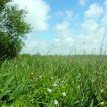
Oudegaasterbrekken, Fluessen and surroundings
- Pays:Pays-Bas (Royaume des)
- Numéro du site:1243
- Superficie:3'054 ha
- Date d’inscription:29-08-2000
- Coordonnées:52°57'N 05°32'E
Le matériel présenté sur ce site web, et en particulier les cartes et l’information territoriale, est tel qu’il apparaît dans les données disponibles et n’implique en aucune manière l’expression d’une opinion quelconque de la part du Secrétariat de la Convention de Ramsar concernant le statut juridique de tout pays, territoire, ville ou zone, ou de ses autorités, ou concernant la délimitation de ses frontières ou limites.
Panorama
The Site is a complex of freshwater lakes surrounded by seasonally flooded agricultural land, reed beds, pastures and peat polders located in the River Rhine catchment area, south-west of the city of Sneek. In 2014 the two Ramsar Sites “Oudegaasterbrekken en omgeving” and “Fluessen / Vogelhoek / Morra” were combined following Natura 2000 boundaries. This resulted in an increase in the total measured area of 170 hectares. The Site regularly supports more than 1% of the individuals of the regional population of barnacle goose (Branta leucopsis), as well as more than 20,000 wintering waterbirds. The Site is a very important feeding and resting area for threatened species such as spotted crake (Porzana porzana), smew (Mergellus albellus) and ruff (Philomachus pugnax). The lakes act as water storage reservoirs providing water for irrigation during summer, while the polders are intensively used for agriculture. Other human activities include commercial fisheries, recreation and boating, water management, conservation and research. Main threats to the ecological character of the Site are nutrient pollution and pressures from tourism.
Région administrative:
Province of Friesland
- Inscription légale nationale:
- National Ecological Network (NEN) - Oudegaasterbrekken, Fluessen en omgeving
- Inscriptions juridiques régionales (internationales):
- UE Natura 2000
- Date de dernière publication:01-11-2022
Téléchargements
Fiche descriptive Ramsar (FDR)
Carte du site
Rapports et documents complémentaires
- Plan de gestion du site
