Rottige Meenthe and Brandemeer
- Pays:Pays-Bas (Royaume des)
- Numéro du site:1277
- Superficie:1'369 ha
- Date d’inscription:29-08-2000
- Coordonnées:52°51'N 05°53'E
Le matériel présenté sur ce site web, et en particulier les cartes et l’information territoriale, est tel qu’il apparaît dans les données disponibles et n’implique en aucune manière l’expression d’une opinion quelconque de la part du Secrétariat de la Convention de Ramsar concernant le statut juridique de tout pays, territoire, ville ou zone, ou de ses autorités, ou concernant la délimitation de ses frontières ou limites.
Panorama
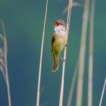
The Site is an open landscape of seasonally flooded farmland with small ponds and canals made by peat excavations in the past. The area lies downstream of the small Linde and Tjonger rivers, and it is rich in wet grasslands and heath, peatland, reed marshes and bog woodland characterized by alder and birch trees. The boundary of the Ramsar Site has been aligned with that of the Natura 2000 site, resulting in the addition of the Brandemeer Nature Reserve and an increase in area of 234 hectares. As a remnant of a once-vast peat bog, the area is not only important for carbon sequestration, but also provides habitat for rare animals and plants. The Site is important for nationally endangered bird species such as the Eurasian wigeon Anas penelope and great reed warbler Acrocephalus arundinaceus, mammals such as the European otter Lutra lutra, and fish such as bitterling Rhodeus amarus and spine loach Cobitis taenia. It is also home to the endemic large copper butterfly. In addition, it supports vulnerable sphagnum moss species and endangered vascular plants such as fen orchid. It is used for recreational purposes including fishing and boating, and features a 15-kilometre hiking trail and a route for canoeing. Additionally, the Site serves as an important centre for conservation and wetland ecosystem research and is involved in studies of natural bogs and wetland and bog restoration ecology. Factors which might adversely affect it include tourism, drainage of surrounding farmlands and eutrophication.
Région administrative:
Friesland
- Inscription légale nationale:
- National Ecological Network (NEN) - Rottige Meenthe & Brandemeer
- Inscriptions juridiques régionales (internationales):
- UE Natura 2000
- Date de dernière publication:06-01-2023
Téléchargements
Fiche descriptive Ramsar (FDR)
FDR archivées
Carte du site
Rapports et documents complémentaires
- Plan de gestion du site
