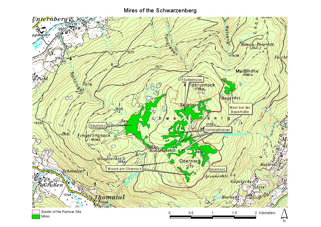
Mires of the Schwarzenberg
- Pays:Autriche
- Numéro du site:1369
- Superficie:267 ha
- Date d’inscription:02-02-2004
- Coordonnées:47°04'N 13°46'E
Le matériel présenté sur ce site web, et en particulier les cartes et l’information territoriale, est tel qu’il apparaît dans les données disponibles et n’implique en aucune manière l’expression d’une opinion quelconque de la part du Secrétariat de la Convention de Ramsar concernant le statut juridique de tout pays, territoire, ville ou zone, ou de ses autorités, ou concernant la délimitation de ses frontières ou limites.
Panorama
Mires of the Schwarzenberg. 02/02/04; Salzburg; 267 ha; 47°05'N 013°47'E. In the subalpine continental climate similar to the boreal, the plateau summit of the Schwarzenberg (1730m) has offered ideal conditions for the development of a natural mire complex of about 80 ha showing typical features of both boreal and alpine peatlands. Paludification mires, spring fens, percolation mires, Aapa mires and bogs present a high biodiversity of plant communities. Boreal vegetation such as the Dwarf Birch (Betula nana), bog cranberry species (Vaccinium microcarpum, Vaccinium oxycoccos) and the Crowberry-Brown Peatmoss (Empetro hermaphroditi-Sphagnetum fusci) are frequent occurrences, as is typical peatland vegetation like Carex pauciflora, Drosera rotundifolia, Menyanthes trifoliata and numerous Sphagnum species. The management authority (Austrian Federal Forestry) intends that there will be no peat extraction, no drainage of mires, no building of forestry roads affecting them, but a non-intensive forestry in the marginal forests and the preclusion of grazing and trampling of the mires. Ramsar site no. 1369. Most recent RIS information: 2003.
Région administrative:
Salzburg
- Date de dernière publication:02-02-2004
Téléchargements
Fiche descriptive Ramsar (FDR)
Carte du site
Rapports et documents complémentaires
- Tistes taxonomiques d'espèces de plantes et d'animaux présents dans le site
- Autre littérature publiée