Deurnsche Peel & Mariapeel
- Pays:Pays-Bas (Royaume des)
- Numéro du site:580
- Superficie:2'734 ha
- Date d’inscription:30-12-1992
- Coordonnées:51°24'N 05°52'E
Le matériel présenté sur ce site web, et en particulier les cartes et l’information territoriale, est tel qu’il apparaît dans les données disponibles et n’implique en aucune manière l’expression d’une opinion quelconque de la part du Secrétariat de la Convention de Ramsar concernant le statut juridique de tout pays, territoire, ville ou zone, ou de ses autorités, ou concernant la délimitation de ses frontières ou limites.
Panorama
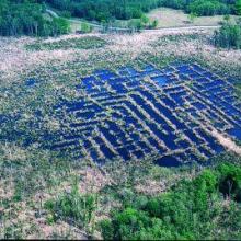
The Site is a former raised bog, with marshland, open water, channels, heathlands, and forests dominated by birch, oak and pine. In 2014 the Site boundary was delineated more accurately and aligned with the Natura 2000 boundary, resulting in the addition of 1,284 hectares. It is of great importance as a representative landscape type specific to the Western European Plain, and it is notable as a resting place for migrating common cranes (Grus grus) and tundra bean geese (Anser serrirostris). The Site plays an important role in groundwater replenishment, and the land is used for farming, recreation and water management. Potential threats to the Site include agricultural intensification, overgrazing, drainage, infrastructure developments and tourism.
Région administrative:
Brabant & Limburg
- Inscription légale nationale:
- National Ecological Network (NEN) - Deurnsche Peel & Mariapeel
- Inscriptions juridiques régionales (internationales):
- UE Natura 2000
- Date de dernière publication:01-11-2022
Téléchargements
Fiche descriptive Ramsar (FDR)
FDR archivées
Carte du site
Rapports et documents complémentaires
- Plan de gestion du site
