Search results
Search found 242 Ramsar Sites covering 64,718,652 ha
- (-) Remove Wetland type: Marine or coastal wetlands filter Wetland type: Marine or coastal wetlands
- (-) Remove Statutory designation taxonomy: Global international legal and other formal filter Statutory designation taxonomy: Global international legal and other formal
- (-) Remove Wetland type: H: Intertidal marshes filter Wetland type: H: Intertidal marshes
- (-) Remove Wetland type: Inland wetlands filter Wetland type: Inland wetlands
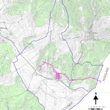
Map
Materials presented on this website, particularly maps and territorial information, are as-is and as-available based on available data and do not imply the expression of any opinion whatsoever on the part of the Secretariat of the Ramsar Convention concerning the legal status of any country, territory, city or area, or of its authorities, or concerning the delimitation of its frontiers or boundaries.
List
-

Dikoe Fen Mire
-
Country:Belarus
-
Designation date:30-03-2015
-
Site number:2263
-
Published since:8 year(s)
23,145 ha -
-

Dinder National Park
-
Country:Sudan
-
Designation date:07-01-2005
-
Site number:1461
-
Published since:19 year(s)
1,084,600 ha -
-
Domica
-
Country:Slovakia
-
Designation date:02-02-2001
-
Site number:1051
-
Published since:17 year(s)
622 ha -
-


Doñana
-
Country:Spain
-
Designation date:04-05-1982
-
Site number:234
-
Published since:17 year(s)
111,646 ha -
-
Ecosistema Arroyo Verde APFF Sierra de Álamos Río Cuchujaqui
-
Country:Mexico
-
Designation date:02-02-2010
-
Site number:1934
-
Published since:14 year(s)
174 ha -
-

Environmental Protection Area of Cananéia-Iguape-Peruíbe
-
Country:Brazil
-
Designation date:04-09-2017
-
Site number:2310
-
Published since:6 year(s)
202,307 ha -
-
Everglades National Park
-
Country:United States of America
-
Designation date:04-06-1987
-
Site number:374
-
Published since:19 year(s)
610,497 ha -
-


Färnebofjärden
-
Country:Sweden
-
Designation date:14-11-2001
-
Site number:1116
-
Published since:7 year(s)
16,866 ha -
-

Gambie-Koulountou
-
Country:Guinea
-
Designation date:14-11-2005
-
Site number:1578
-
Published since:7 year(s)
368,193 ha -
-

Glacial lakes in the Tatra National Park
-
Country:Poland
-
Designation date:11-12-2017
-
Site number:2340
-
Published since:5 year(s)
571 ha -