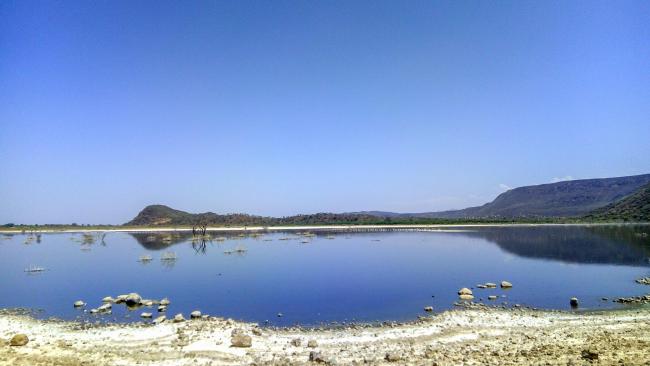
Lake Bogoria
Lake Bogoria
- Country:
- Kenya
- Site number:
- 1097
- Area:
- 10,700.0 ha
- Designation date:
- 27-08-2001
- Coordinates:
- 00°15'55"N 36°06'11"E
Carousel
CarouselMaterials presented on this website, particularly maps and territorial information, are as-is and as-available based on available data and do not imply the expression of any opinion whatsoever on the part of the Secretariat of the Ramsar Convention concerning the legal status of any country, territory, city or area, or of its authorities, or concerning the delimitation of its frontiers or boundaries.
Lake Bogoria is an alkaline soda lake in the Great Rift Valley of East Africa, which is dominated by hot springs. The Site is a UNESCO World Heritage Site and an Important Bird and Biodiversity Area (IBA). Its rich biodiversity supports more than 300 waterbird species; and an important stopover site for a population of up to 1.5 million migratory birds, such as the lesser flamingo (Phoeniconaias minor). Its shoreline and associated acacia woodlands provide critical habitat for vulnerable species such as the common hippopotamus (Hippopotamus amphibius) and African lion (Panthera leo), and other important species such as the greater kudu (Tragelaphus strepsiceros). The lake’s stable water level makes it doubly important during periods of drought, when water levels in other East African lakes drop. The area is inhabited by Tugen and Jemps pastoralists, and livestock grazing is the main land use in the area, but tourism brings 200,000 visitors a year, who are attracted by the wildlife, hot springs, spectacular cliffs and escarpments and rich indigenous culture. In addition, the geysers are believed by some to have medicinal value. The Site has a management plan.
- World Heritage site
- National Reserve - Lake Bogoria National Reserve
- KE1097RIS_2405_en.pdf
- KE1097RISformer_161121.pdf
- KE1097_map1602.pdf
- KE1097_taxo160915.pdf
- KE1097_taxo160915_1.pdf
- KE1097_mgt231220.pdf


