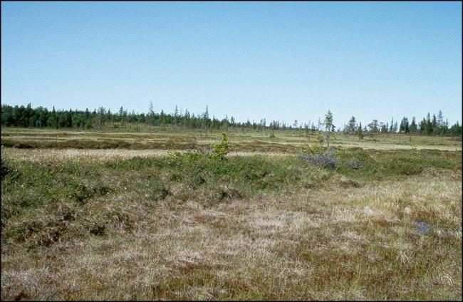
Aloppkölen-Köpmankölen
Aloppkölen-Köpmankölen
- Country:
- Sweden
- Site number:
- 1113
- Area:
- 20,079.0 ha
- Designation date:
- 19-11-2001
- Coordinates:
- 62°38'24"N 13°40'01"E
Carousel
CarouselMaterials presented on this website, particularly maps and territorial information, are as-is and as-available based on available data and do not imply the expression of any opinion whatsoever on the part of the Secretariat of the Ramsar Convention concerning the legal status of any country, territory, city or area, or of its authorities, or concerning the delimitation of its frontiers or boundaries.
The Site is a large wetland complex composed of northern bogs, mixed mires including well developed string mixed mires, soligenous and string fens, wet forests and numerous lakes, pools, streams and springs. In the northern parts of the Site, vegetation is dominated by heather and cloudberry, while sedge and Sphagnum mosses dominate in the southern parts. The wet mires support a rich avifauna including large numbers of waders and other waterbirds such as the nationally threatened common reed bunting Emberiza schoeniclus and ruff Philomachus pugnax, which use the Site as breeding and foraging grounds. The springs and spring fens support a typical diversity. The Site is used for hunting, fishing and cloudberry picking, and also provides livestock fodder for reindeer husbandry by the local Sami population. The threats affecting the ecological character of the Site are limited; however mining and quarrying could have a major impact. The management plans for Henvålen and Kilbäcksskiftet nature reserves cover part of the Ramsar Site. A restoration plan is being implemented to counteract the acidification of its streams.
Administrative region:
Jämtland county
National legal designation:
- Nature Reserve 1 - Henvålen
- Nature Reserve 2 - Kilbäcksskiftet
Regional (international) legal designations:
- EU Natura 2000
Last publication date:
25-01-2017
Ramsar Information Sheet (RIS)
- SE1113RIS_1701_en.pdf
- SE1113RISformer_150218.pdf
- SE1113_map1503.pdf
Archived RIS
Site map
Additional reports and documents
Other published literature

