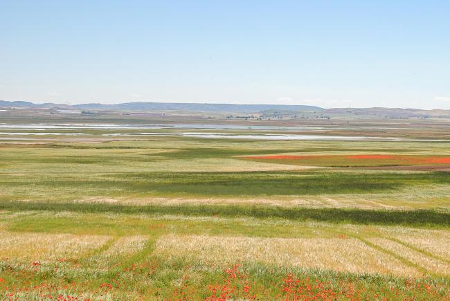
Laguna de El Hito
Laguna de El Hito
- Country:
- Spain
- Site number:
- 1259
- Area:
- 573.4 ha
- Designation date:
- 20-12-2002
- Coordinates:
- 39°52'01"N 02°41'25"W
Carousel
CarouselMaterials presented on this website, particularly maps and territorial information, are as-is and as-available based on available data and do not imply the expression of any opinion whatsoever on the part of the Secretariat of the Ramsar Convention concerning the legal status of any country, territory, city or area, or of its authorities, or concerning the delimitation of its frontiers or boundaries.
This highly saline seasonal lagoon with associated islands lies in a large enclosed (endorheic) drainage basin fed by groundwater, rainwater and surface water, and regularly dries out. It is one of the best examples of a steppe pool with rich submerged aquatic vegetation and adjoining salt marsh and steppe habitats in Spain. The Site is an important area for many waterbirds such as the nationally endangered Eurasian curlew (Numenius arquata) and the common snipe (Gallinago gallinago). Climate change has led to enduring droughts and unusually prolonged periods with little or no inundation. Human activities include scientific research and birdwatching.
- Humedal del Inventario Español de Zonas Húmedas - Humedal IH423010–Laguna de El Hito. Resolución de 9 de octubre de 2018, de la Dirección General de Biodiversidad y Calidad Ambiental, por la que se incluyen en el IEZH 34 humedales de Castilla-La Mancha (BOE nº 51, del 28 de febrero de 2019)
- Reserva Natural - Reserva Natural de la Laguna de El Hito. Decreto 26/2002, de 12 de febrero, por el que se aprueba el Plan de Ordenación y se declara la Reserva Natural de la Laguna de El Hito (Cuenca) (DOCM nº 26, de 1 de marzo de 2002)
- EU Natura 2000
- ES1259RIS_2206_es.pdf
- ES1259RISformer_210628.pdf
- ES1259_map211215. EL HITO Mapa Color ene. 22.jpg
- ES1259_taxo220210. HITO Anexo 6.1.2.i Listas sps-censos ene. 22 .pdf


