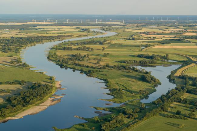
Aland-Elbe-Lowland and Elbe-wetland Jerichow
Aland-Elbe-Lowland and Elbe-wetland Jerichow
- Country:
- Germany
- Site number:
- 1307
- Area:
- 8,605.0 ha
- Designation date:
- 21-02-2003
- Coordinates:
- 52°44'28"N 11°50'34"E
Carousel
CarouselMaterials presented on this website, particularly maps and territorial information, are as-is and as-available based on available data and do not imply the expression of any opinion whatsoever on the part of the Secretariat of the Ramsar Convention concerning the legal status of any country, territory, city or area, or of its authorities, or concerning the delimitation of its frontiers or boundaries.
The Site comprises two large lowland areas in the flood zones of the Elbe River, both of them Special Protection Areas (SPA) under the European Union Directive on the Conservation of Wild Birds: Aland-Elbe-lowland and Elbe River meadow Jerichow. Both areas are composed of floodplain meadows which remain near-natural despite anthropogenic changes, with dynamic floodplain development and regular flooding occurring at a reduced level. The Site is also part of the Flusslandschaft Elbe Biosphere Reserve. The area is of outstanding importance for breeding, resting and wintering waterbirds, waders and grassland species; it harbours large gatherings of northen pintail (Anas acuta), northern shoveler (Anas clypeata) and bean goose (Anser fabalis). The Site is also an essential migration stopover for the vulnerable common pochard (Aythya ferina). The area offers opportunities for research and educational activities. There is some current threat to the ecological character of the Site from agricultural and forestry effluents reaching the floodplains.
- UNESCO Biosphere Reserve
- Landscape reserve - Aland-Elbe Niederung
- Nature reserve - Aland-Elbe-Niederung Schelldorfer See, Elsholzwiesen, Bucher Brack-Bölsdorfer Haken
- landscape reserve - Untere Havel
- EU Natura 2000
