

Garaet Annk Djemel et El Merhsel
- Country:Algeria
- Site number:1420
- Area:18,140 ha
- Designation date:12-12-2004
- Coordinates:35°47'N 06°48'E
Materials presented on this website, particularly maps and territorial information, are as-is and as-available based on available data and do not imply the expression of any opinion whatsoever on the part of the Secretariat of the Ramsar Convention concerning the legal status of any country, territory, city or area, or of its authorities, or concerning the delimitation of its frontiers or boundaries.
Overview
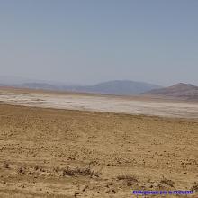
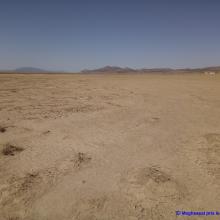
The Site is made up of a chott and a sebkha, a salt lake surrounded by a belt of Salicornia, Artemisia and Atriplex vegetation, fed by temporary rivers, precipitation and runoff. During summer the high evaporation rates lead to the creation of salt encrustations, which are valuable habitats for some bird species. The Site hosts the vulnerable marbled teal Marmaronetta angustirostris, as well as over 12% of the biogeographic population of common shelduck Tadorna tadorna and over 2% of the population of greater flamingo Phoenicopterus roseus. It also plays an important role in flood control and sediment capture. The local population harvests salt and farms the surrounding areas. Erosion is caused by the characteristics of the rocks, torrential rains and the absence of vegetation which is worsened by permanent ovine and bovine overgrazing. There is no scientific, tourist or educational activity, but the Site could potentially support environmental awareness-raising.
Administrative region:
Oum El Bouaghi
- Last publication date:09-05-2019
Downloads
Ramsar Information Sheet (RIS)
Archived RIS
Site map
Additional reports and documents
- Taxonomic lists of plant and animal species occurring in the site
