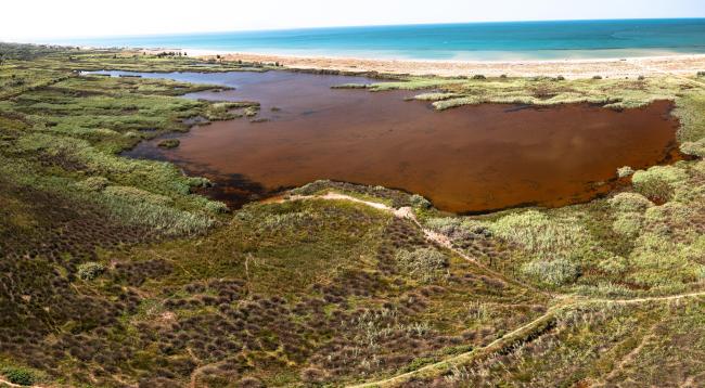
Oasis of Castelvolturno - Variconi
Oasis of Castelvolturno - Variconi
- Country:
- Italy
- Site number:
- 1664
- Area:
- 195.0 ha
- Designation date:
- 07-08-2003
- Coordinates:
- 41°01'15"N 13°56'03"E
Carousel
CarouselMaterials presented on this website, particularly maps and territorial information, are as-is and as-available based on available data and do not imply the expression of any opinion whatsoever on the part of the Secretariat of the Ramsar Convention concerning the legal status of any country, territory, city or area, or of its authorities, or concerning the delimitation of its frontiers or boundaries.
This Site lies on the left bank of the Volturno delta in southern Italy and includes freshwater ponds surrounded by marshes and a saline lagoon separated by an artificial levee which connects the riparian strip with the mainland. It belongs to the last remaining portion of a formerly vast complex of swamps which was drained between the 17th and 18th centuries. Many bird species use the Site as a migration stopover or for wintering, including protected species such as the greater flamingo (Phoenicopterus roseus), the knot (Calidris canutus) and the near-threatened ferruginous duck (Aythya nyroca). River regulation and tourism are seen as a potential threat. There is a bird observation hut and a nature trail as well as educational activities for schoolchildren.
- regional nature reserve
- EU Natura 2000
- IT1664RIS_2211_en.pdf
- IT1664RISformer_211018.pdf
