Baltic Sea Lagoons of Westrügen- Island Hiddensee-Peninsula Zingst
Baltic Sea Lagoons of Westrügen- Island Hiddensee-Peninsula Zingst
- Country:
- Germany
- Site number:
- 170
- Area:
- 26,290.0 ha
- Designation date:
- 31-07-1978
- Coordinates:
- 54°27'30"N 13°07'03"E
Carousel
CarouselMaterials presented on this website, particularly maps and territorial information, are as-is and as-available based on available data and do not imply the expression of any opinion whatsoever on the part of the Secretariat of the Ramsar Convention concerning the legal status of any country, territory, city or area, or of its authorities, or concerning the delimitation of its frontiers or boundaries.
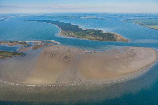
This complex of lagoons, islands and peninsulas on the Baltic coast includes the lagoons west of Rügen island as well as Hiddensee island and the eastern part of the Zingst peninsula. It features temporarily flooded sand and mud flats, reed beds and shorelines varying from high cliffs at the northern tip of Hiddensee to pebble or sandy beaches. The land area of about 5,600 hectares consists of salt marshes, heath, the hilly moraines of the northern part of Hiddensee and several small islands, some of them hosting important colonies of coastal birds. These areas are important breeding grounds for coastal birds as well as important resting sites. Species such as the European golden plover (Pluvialis apricaria) and the common crane (Grus grus), which use the Site for resting and wintering, are found in numbers that represent more than one per cent of the bioregional population. Invasive species such as mammal predators pose a threat to breeding birds, while native species such as foxes and wild boars are also problematic for bird colonies. A management plan is being implemented.
- national park - Nationalpark Vorpommersche Boddenlandschaft
- nature reserve - Dornbusch und Schwedenhagener Ufer Dünenheide auf der Insel Hiddensee
- EU Natura 2000
- Other international designation
- DE170RIS_2409_en.pdf

