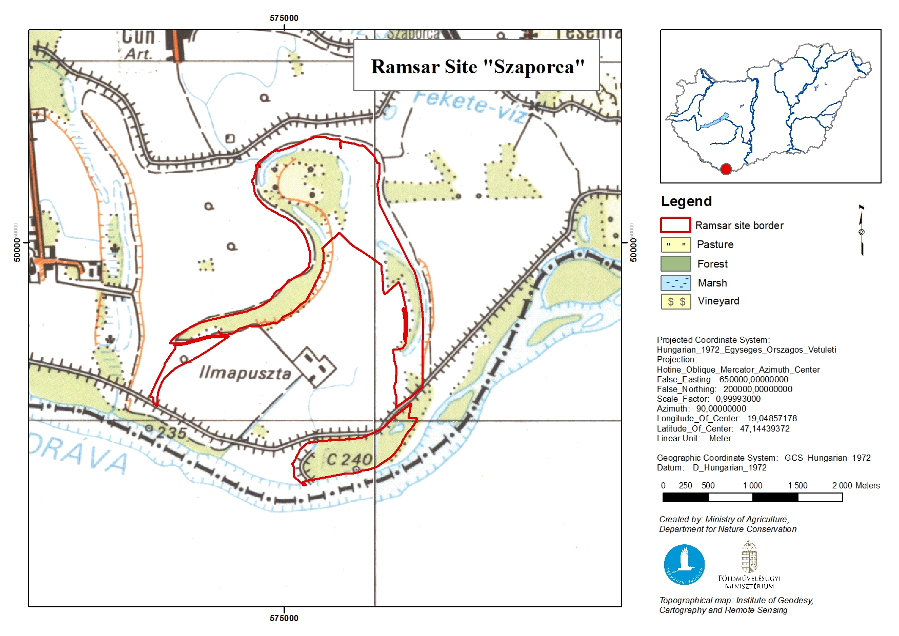
Szaporca
Szaporca
- Country:
- Hungary
- Site number:
- 182
- Area:
- 289.5 ha
- Designation date:
- 11-04-1979
- Coordinates:
- 45°47'12"N 18°05'22"E
Carousel
Carousel
Materials presented on this website, particularly maps and territorial information, are as-is and as-available based on available data and do not imply the expression of any opinion whatsoever on the part of the Secretariat of the Ramsar Convention concerning the legal status of any country, territory, city or area, or of its authorities, or concerning the delimitation of its frontiers or boundaries.
Szaporca Ramsar Site is an oxbow lake that developed naturally from the River Dráva, which supports gallery forests, wet meadows, reedbeds, agricultural land and marshes. The Site is important for numerous species of breeding waterbirds such as the ferruginous duck (Aythya nyroca) and the Eurasian bittern (Botaurus stellaris). It also supports diverse floating vegetation communities such as Lemno-Utricularietum and Nuphareto-Castalietum. River regulation works in the late 1980s had a negative impact on the Site, creating a permanent separation between the river and its former riverbed. Since then, water supply has been managed through sluices connected to the River Dráva. The wetland area plays an important role in groundwater recharge and the maintenance of the hydrological balance. Human activities include agriculture and tourism. The main threats are overfishing and colonization by exotic invasive plant species such as the Canada goldenrod (Solidago canadensis) and the Judas tree (Cercis siliquastrum).
Administrative region:
County of Baranya
National legal designation:
- national park - Duna-Dráva National Park
Regional (international) legal designations:
- EU Natura 2000
Last publication date:
25-11-2015
Ramsar Information Sheet (RIS)
- HU182RIS_1511_en.pdf
Archived RIS