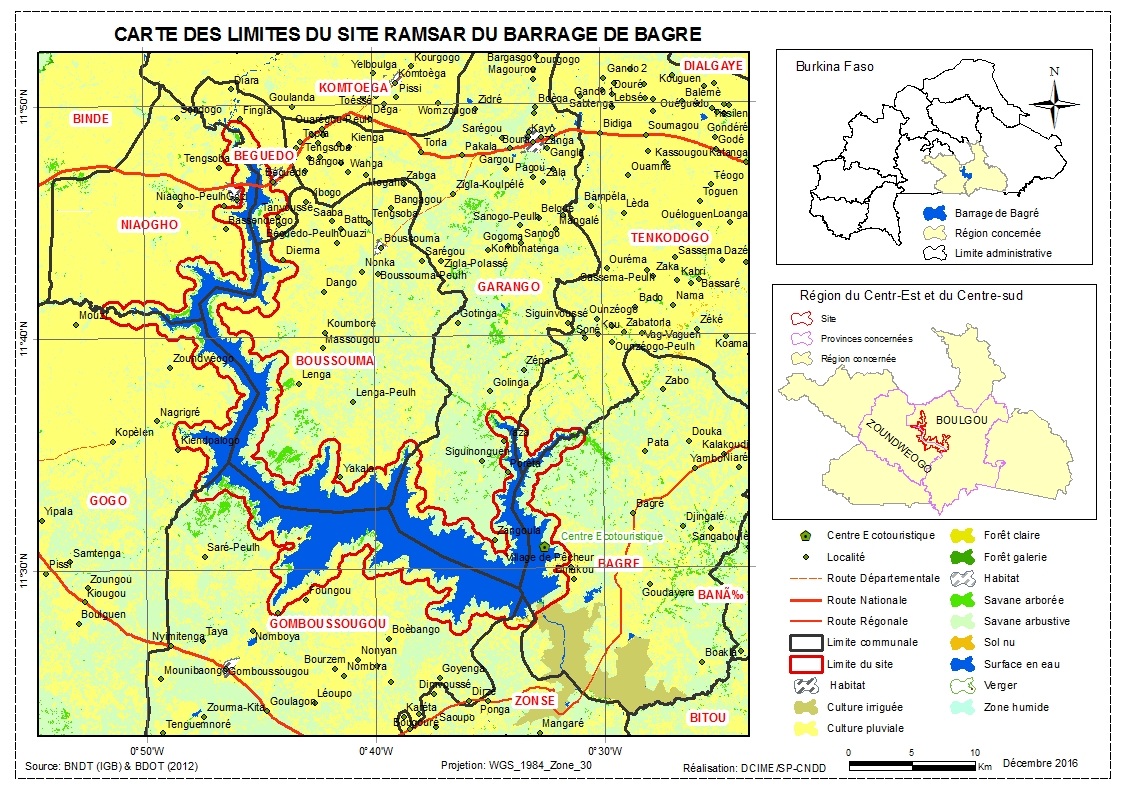
Barrage de Bagre
Barrage de Bagre
- Country:
- Burkina Faso
- Site number:
- 1874
- Area:
- 36,793.0 ha
- Designation date:
- 07-10-2009
- Coordinates:
- 11°34'57"N 00°41'13"W
Carousel
Carousel


Materials presented on this website, particularly maps and territorial information, are as-is and as-available based on available data and do not imply the expression of any opinion whatsoever on the part of the Secretariat of the Ramsar Convention concerning the legal status of any country, territory, city or area, or of its authorities, or concerning the delimitation of its frontiers or boundaries.
The Bagré Dam, located in the northern Sudanian phytogeographic area, is composed of an artificial permanent freshwater lake and the irrigated lakeside land. The Site is very rich in biodiversity: it is home to trees and shrubs such as Lannea acida, Vitellaria paradoxa, Tamarindus indica, Khaya senegalensis, Acacia albida and Acacia gourmaensis, and to fish, amphibian, mollusc and aquatic reptile communities. The hippopotamus is the most notable species on the Site, with a total estimated number of 100 individuals. Their presence indirectly supports several valued species of fish in the lake, so they too are valued and protected. The Site is valuable not only for biodiversity conservation but also erosion control, sediment and nutrient retention, storm protection and groundwater replenishment. The stable waters of the lake enable numerous socio-economic and agricultural activities. Poor farming practices have led to soil erosion on the banks and resulting siltation.
Administrative region:
Centre-Est et Centre-Sud
Last publication date:
27-03-2017
Ramsar Information Sheet (RIS)
- BF1874RIS_1703_fr.pdf
- BF1874RISformer_160725.pdf
Archived RIS
Site map