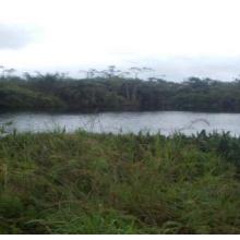


Loubetsi-Nyanga
- Country:Congo
- Site number:2221
- Area:251,151.1 ha
- Designation date:02-02-2015
- Coordinates:02°55'S 12°01'E
Materials presented on this website, particularly maps and territorial information, are as-is and as-available based on available data and do not imply the expression of any opinion whatsoever on the part of the Secretariat of the Ramsar Convention concerning the legal status of any country, territory, city or area, or of its authorities, or concerning the delimitation of its frontiers or boundaries.
Overview
Characterized by a range of habitats including dryland gallery forests, swamp forests and river bodies, the Loubetsi-Nyanga is an important biological reserve which supports varied flora, macroinvertebrates, fish, reptiles, birds and terrestrial mammals, and provides refuge for several notable species including the forest elephant, gorilla, chimpanzee, hippopotamus, hyena, leopard, lycaon and the giant ground pangolin. The Site is also home to the Nile crocodile (Crocodylus niloticus), African dwarf crocodile (Osteolaemus tetraspis) and the critically endangered slender-snouted crocodile (Mecistops cataphractus). The hydrological functions of the Site include sediment retention, flood control and groundwater recharge. The local communities, estimated at 12,500 inhabitants, are highly dependent on the numerous resources of the Site for food, medicine, transportation and goods for trading with nearby towns. Slash-and-burn agricultural practices, poaching, and illegal logging are the major threats to the Site.
Administrative region:
Niari
- Last publication date:16-10-2015
