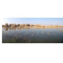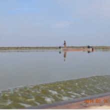


Hammar Marsh
- Country:Iraq
- Site number:2242
- Area:180,000 ha
- Designation date:07-04-2014
- Coordinates:30°48'N 47°01'E
Materials presented on this website, particularly maps and territorial information, are as-is and as-available based on available data and do not imply the expression of any opinion whatsoever on the part of the Secretariat of the Ramsar Convention concerning the legal status of any country, territory, city or area, or of its authorities, or concerning the delimitation of its frontiers or boundaries.
Overview
Hammar Marsh is one of the three marshes (along with Central Marshes, Ramsar Site no. 2241, and Hawizeh Marsh, Site no. 1718) that make up the once extensive and biodiverse Mesopotamian marshlands in southern Iraq. All three have now been designated as Ramsar Sites and so are under international conservation management.
Historically, Hammar Marsh extended up to 4,500 square kilometres during periods of seasonal floods. However, draining in the early 1990s and the building of several roads, canals and embankments dried and altered the natural environment. In the 2000s, re-flooding and restoration projects brought back water and some of the biodiversity.
The Site provides regionally important regulating services such as flood control, water storage and purification, and climate regulation. It supports globally threatened species such as the endangered Basra reed warbler (Acrocephalus griseldis) and the marbled duck (Marmaronetta angustirostris). It also hosts the globally vulnerable Mesopotamichthys sharpeyi and the Euphrates softshell turtle (Rafetus euphraticus). The dominant fish is Redbelly tilapia (Tilapia zillii), an invasive non-native species.
The area is of historical and cultural value with the local Marsh Arab community relying on the marsh environment and resources for the construction of their unique floating buildings, as well as their traditional way of living. The main economic activities are agriculture, hunting and fishing. In recent decades, oil exploration has begun around the marshlands.
Administrative region:
Al-Nasyriah Province
- Last publication date:24-09-2015
Downloads
Ramsar Information Sheet (RIS)
Site map
Additional reports and documents
- Other published literature
