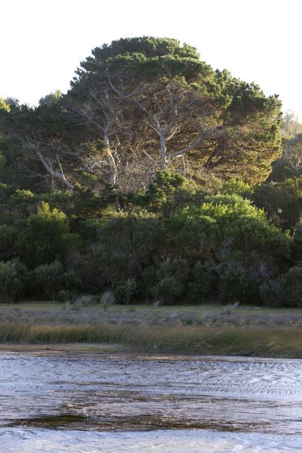
Little Waterhouse Lake
Little Waterhouse Lake
- Country:
- Australia
- Site number:
- 260
- Area:
- 56.0 ha
- Designation date:
- 16-11-1982
- Coordinates:
- 40°52'25"S 147°36'42"E
Carousel
CarouselMaterials presented on this website, particularly maps and territorial information, are as-is and as-available based on available data and do not imply the expression of any opinion whatsoever on the part of the Secretariat of the Ramsar Convention concerning the legal status of any country, territory, city or area, or of its authorities, or concerning the delimitation of its frontiers or boundaries.
A coastal freshwater lagoon situated in the Waterhouse Conservation Area on the north-east coast of Tasmania, receiving its water from local catchment runoff and also from a small drain (formerly a creek) known as Tobacco Creek. The lake is an excellent example of a small freshwater lake impounded behind coastal dunes. The site contains over 40 species of aquatic and semi-aquatic plants, and also the green and gold frog (Litoria raniformis, also known as the Southern bell frog) and the dwarf galaxias (Galaxiella pusilla), which are both listed as vulnerable nationally. The area around Little Waterhouse Lake is significant to indigenous groups. The North East people used the heaths and plains behind the coast, which they kept open and clear by burning. The Site is currently used for various recreational activities, particularly fishing as the lake is stocked with brown trout and rainbow trout.
- Protected area - Waterhouse Conservation Area
- AU260RIS_2207_en.pdf
- AU260RISformer1998.pdf
- AU260RISformer_190603.pdf
- AU260map2.pdf
- AU260_map210423.pdf
- AU260ECD2012.pdf
- AU260_mgt220630.pdf


