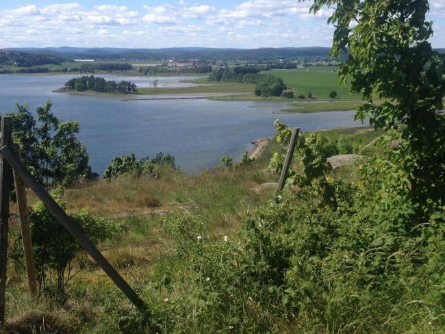
Ilene and Presterodkilen Wetland System
Ilene and Presterodkilen Wetland System
- Country:
- Norway
- Site number:
- 308
- Area:
- 216.0 ha
- Designation date:
- 24-07-1985
- Coordinates:
- 59°16'11"N 10°24'33"E
Carousel
CarouselMaterials presented on this website, particularly maps and territorial information, are as-is and as-available based on available data and do not imply the expression of any opinion whatsoever on the part of the Secretariat of the Ramsar Convention concerning the legal status of any country, territory, city or area, or of its authorities, or concerning the delimitation of its frontiers or boundaries.
The Site consists of two separate nature reserves. Ilene is a classic delta and area of shallow water in the inner part of a narrow fjord arm around the mouth of the Aulielva river. The area contains a mosaic of mudflats, saltmarsh, reedbeds, sedge belts and heather-covered areas of pinewood. Presterødkilen is a shallow coastal bay surrounded by reedbeds. The shallow waters are built up with alluvial deposits and postglacial marine clay and are rich in algae, snails, mussels and other invertebrates. Both areas are exposed at low tide and are important feeding sites for ducks and waders. A total of 240 bird species and 200 plants have been recorded at the Site. It is also important for wintering and breeding birds, including several nationally threatened species. Pink-footed geese (Anser brachyrhynchus) stage and feed in the area in significant number during the migration in spring and autumn. The Site functions as a sediment trap and offers habitat to the brown trout (Salmo trutta). Ilene is considered among the best sites for birdwatching in the county, and there is an information centre and a birdwatching tower. A footpath through the area helps to channel visitors and thereby reduce disturbance. Due to its proximity to the city of Tønsberg the Site is slightly affected by noise and pollution from traffic.
- nature reserve - Ilene & Presterødkilen
- NO308RIS_2305_en.pdf
- NO308RISformer.pdf
- NO308RISformer_171024.pdf
- NO308RISformer_220720_1807_en.pdf
- NO308_map180516.pdf

