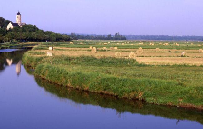
Marais du Cotentin et du Bessin, Baie des Veys
Marais du Cotentin et du Bessin, Baie des Veys
- Country:
- France
- Site number:
- 516
- Area:
- 38,891.4 ha
- Designation date:
- 05-04-1991
- Coordinates:
- 49°19'33"N 01°14'11"W
Carousel
CarouselMaterials presented on this website, particularly maps and territorial information, are as-is and as-available based on available data and do not imply the expression of any opinion whatsoever on the part of the Secretariat of the Ramsar Convention concerning the legal status of any country, territory, city or area, or of its authorities, or concerning the delimitation of its frontiers or boundaries.
The Site consist of an extensive complex of marshes and associated floodplains converging at a coastal bay. Vegetation consists of converted and unconverted wet grassland and the largest peatlands in France. The area is extremely important for breeding, staging and wintering numerous species of waterbirds such as the vulnerable aquatic warbler (Acrocephalus paludicola). It provides habitat for a variety of passerines and various species of notable plants. Human activities include pastoralism, hunting and fishing. As agriculture declines, natural succession will occur, ultimately replacing plant and animal species of great conservation importance with woodland species. The principal aim of the park is to maintain extensive agricultural practices to preserve the marsh habitat.
- Réserve Naturelle Nationale - Réserve Naturelle Nationale de la Sangsurière et de l’Adriennerie
- Réserve naturelle nationale - Réserve naturelle nationale du Domaine de Beauguillot
- parc naturel régional - Parc naturel régional des Marais du Cotentin et du Bessin
- réserve de chasse et de faune sauvage - réserve de chasse et de faune sauvage des Bohons
- EU Natura 2000
- FR516RIS_2307_fr.pdf
- FR516RISformer_170731.pdf
- FR516_map221114.pdf
- FR516_taxo171222.compressed.pdf
- FR516_taxo201026.pdf
- FR516_taxo201026_1.pdf


