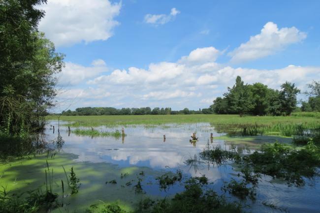
Basses Vallees Angevines
Basses Vallees Angevines
- Country:
- France
- Site number:
- 715
- Area:
- 7,136.0 ha
- Designation date:
- 19-01-1995
- Coordinates:
- 47°33'46"N 00°30'44"W
Carousel
CarouselMaterials presented on this website, particularly maps and territorial information, are as-is and as-available based on available data and do not imply the expression of any opinion whatsoever on the part of the Secretariat of the Ramsar Convention concerning the legal status of any country, territory, city or area, or of its authorities, or concerning the delimitation of its frontiers or boundaries.
The Site consists of a vast alluvial plain encompassing the confluence of four rivers and supporting grasslands dominated by various communities of wet-meadow plants and sparse rows of ash and willow. The wetland supports various threatened, endemic or rare plants. It is a stopover point of international importance for several ducks and geese and wading birds on the spring migration from their wintering grounds to their breeding grounds in northern and northeastern Europe, and it provides internationally important wintering and nesting habitat for several species of waterbirds. Some notable species as the corncrake (Crex crex) and spotted crake (Porzana porzana) breed in the Site. The Site has been home to the European beaver (Castor fiber) since 2004: the species appears to be well established, with three or four family units identified. The vulnerable alpine longhorn beetle (Rosalia alpina) is also present. Human activities include agriculture, forestry, boating, fishing and bird hunting; the Site has been used for extensive mowing and grazing, depending on the hydrological conditions.
- none
- EU Natura 2000
- FR715RIS_2307_fr.pdf
- FR715RISformer1994_EN.pdf
- FR715RISformer_170728.pdf
- FR715_map221025.jpeg
- FR715_taxo221026.pdf
- FR715_taxo221026_1.pdf


