Search results
Search found 8 Ramsar Sites covering 156,564 ha
- (-) Remove Picture available?: Yes filter Picture available?: Yes
- (-) Remove Sites on Montreux record?: No filter Sites on Montreux record?: No
- (-) Remove Threats: Agriculture & aquaculture filter Threats: Agriculture & aquaculture
- (-) Remove Ramsar criteria: 7 filter Ramsar criteria: 7
- (-) Remove Designation date: 2003 filter Designation date: 2003
- (-) Remove Threats: Transportation and service corridors filter Threats: Transportation and service corridors
Map
Materials presented on this website, particularly maps and territorial information, are as-is and as-available based on available data and do not imply the expression of any opinion whatsoever on the part of the Secretariat of the Ramsar Convention concerning the legal status of any country, territory, city or area, or of its authorities, or concerning the delimitation of its frontiers or boundaries.
List
-

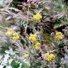


Lower Dniester
-
Country:Republic of Moldova
-
Designation date:20-08-2003
-
Site number:1316
-
Published since:20 year(s)
60,000 ha -
-

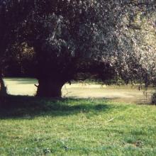
Aquatic-coastal complex of Cape Opuk
-
Country:Ukraine
-
Designation date:17-11-2003
-
Site number:1395
-
Published since:20 year(s)
775 ha -
-

Aquatic-cliff complex of Karadag
-
Country:Ukraine
-
Designation date:17-11-2003
-
Site number:1394
-
Published since:20 year(s)
224 ha -
-


Bahía de Panamá
-
Country:Panama
-
Designation date:20-10-2003
-
Site number:1319
-
Published since:4 year(s)
85,665 ha -
-


Dnipro-Oril Floodplains
-
Country:Ukraine
-
Designation date:17-11-2003
-
Site number:1399
-
Published since:2 year(s)
2,560 ha -
-


Lower Smotrych River
-
Country:Ukraine
-
Designation date:17-11-2003
-
Site number:1401
-
Published since:2 year(s)
1,480 ha -
-


Bakotska Bay
-
Country:Ukraine
-
Designation date:17-11-2003
-
Site number:1396
-
Published since:2 year(s)
1,590 ha -
-


Desna River Floodplains
-
Country:Ukraine
-
Designation date:17-11-2003
-
Site number:1398
-
Published since:2 year(s)
4,270 ha -